

UN Replaces Mercator Map with Equal Earth Projection in Historic Vote
The United Nations has voted to drop the 16th-century Mercator world map in favor of the Equal Earth Projection. The decision corrects severe historical distortions that made continents like Africa appear vastly smaller than they are in reality.
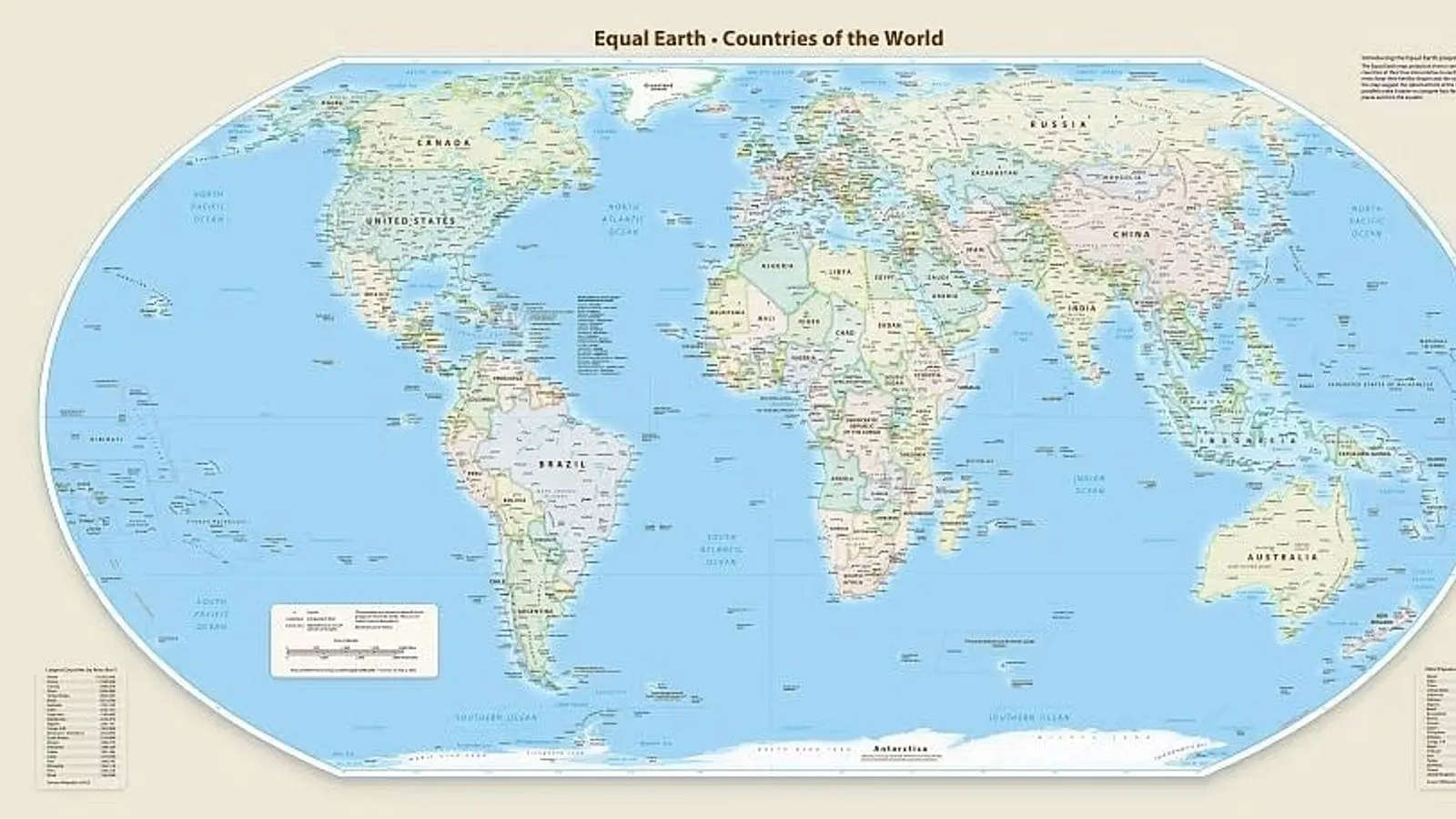
In a significant geopolitical and cartographic shift, the United Nations has officially decided to discard the centuries-old Mercator world map, a standard navigational tool dating back to the sixteenth century. The landmark resolution, which marks a major departure in how global geography is visually represented in international institutions, was finalized on the fourth of September at the United Nations headquarters.
To replace the traditional Mercator layout, the UN General Assembly voted to adopt the 'Equal Earth Projection' as its new official world map. During the formal proceedings at the United Nations, a decisive total of one hundred and sixty-four countries cast their votes in favor of adopting the new equal-area projection.
Despite the overwhelming global consensus, the vote was not entirely unanimous. The United States opposed the measure by voting directly against the proposal, while a separate group of six nations chose to abstain and ultimately did not participate in the final voting tally.
The motivation behind replacing the Mercator map stems from longstanding criticisms regarding its severe geographic distortions, particularly concerning landmass sizes near the poles versus the equator. Under the outdated Mercator projection, Greenland was historically depicted as being roughly the same size as the entire continent of Africa. In stark contrast to this visual distortion, geographical reality dictates that the African continent is actually about fourteen times larger than Greenland.
The 'Equal Earth Projection' itself has a relatively recent origin compared to the map it is replacing. It was first introduced to the public during a specialized conference held in the year two thousand and eighteen by the North American Cartographic Information Society.
Addressing the profound implications of this historic cartographic change, Amma Tum-Amoah, representing Togo and the African Union, delivered a powerful statement highlighting the renewed visibility for the continent. "যে আফ্রিকাকে এত দিন মানচিত্রে ছোট করে দেখানো হতো, তা এখন ভৌগোলিক, ঐতিহাসিক, নৈতিক, সাংস্কৃতিক, অর্থনৈতিক ও কূটনৈতিক সব দিক থেকেই নিজের প্রকৃত গুরুত্ব ও আকার বিশ্বজুড়ে তুলে ধরতে দৃঢ়প্রতিজ্ঞ," Amma Tum-Amoah stated, emphasizing that Africa is now determined to project its true importance and scale worldwide across all geographic, historical, moral, cultural, economic, and diplomatic dimensions.